Dangerous Hiking Spots To Avoid Across The US
Some trails promise breathtaking views, but the risks lurking along the path can turn a dream into a nightmare. While adventure seekers are often drawn to the thrill of conquering nature, certain trails pose dangers that go beyond the "challenge" category. From unpredictable weather and wildlife encounters to sheer drop-offs and flash floods, some hiking trails demand more than stamina and a good pair of boots.
Unlike well-maintained paths in popular parks, some trails are wild, remote, and unforgiving. Rescues can be complicated by limited cell service or the sheer difficulty of reaching stranded hikers. Others seem deceptively safe until conditions change suddenly, like a flash flood roaring through a slot canyon or a sudden gust of wind on a narrow ridge. What starts as a scenic day hike can quickly spiral into a life-threatening ordeal.
The following hiking spots and trails across the U.S. have gained a reputation for being especially dangerous. Whether it's due to isolation, extreme weather, or hazardous terrain, these trails are not for the unprepared. If adventure calls, make sure you know the risk before heading out. Some paths may not be worth the gamble. Read on to discover some of the most dangerous hiking spots to avoid across the United States.
Getting lost is a serious threat in The Maze
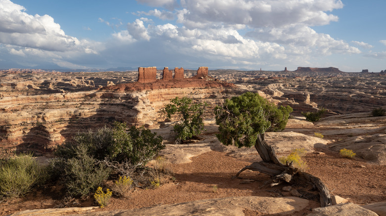
The Maze in Canyonlands National Park in Utah is one of the most remote and treacherous hiking spots in the country. The biggest threat here aren't the wild animals or sheer drops — it's disorientation. Known for its labyrinth-like network of narrow canyons, dead-end passages, and sandstone cliffs, it's a place where even experienced hikers can lose their way, as adventure blogger Mindy on the Move discovered.
Unlike popular trails with clear signage, The Maze offers no such guidance. What's really trippy is that the sandstone corridors all look eerily similar, making it easy to lose track of direction. Hikers can walk in circles for hours without even realizing it. Navigating its twisting paths requires exceptional orienteering skills. Knowing how to read a map and route descriptions are very helpful, but even those can be misleading in this deceptive environment. Plus, with little to no cell service, calling for help isn't really an option.
The weather is another serious danger. With temperatures soaring above 100°F in the summer and shade hard to come by, heat exhaustion and dehydration are constant risks. In winter, the nights get extremely cold, making hypothermia a concern. Water sources are scarce, so hikers must carry ample supplies, which adds to the physical strain. The Maze is a true backcountry experience where preparation is essential. Without thorough planning and survival skills, hikers risk getting stuck for days in its winding passages. If you're considering The Maze, be aware that this trail is not for casual hikers. Novice hikers are generally recommended to steer clear of this U.S. National Park trail. Though it's ruggedly beautiful, it's a place where one wrong turn can leave you completely stranded.
One misstep could be fatal on the Mist Trail
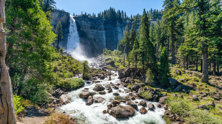
The Mist Trail in Yosemite National Park along the famous Half Dome is one of the most iconic hikes in the United States. Its breathtaking views of waterfalls and stunning granite landscapes are just a few of the reasons it's one of many bucket list destinations for adventurers around the world. However, its beauty comes with real risks. One of the primary dangers lies in the steep, slick granite steps near Nevada Falls. These steps, constantly damp from the mist of the waterfall, become dangerously slippery, making even the most experienced hikers prone to falls. The trail's name isn't just for show — the mist that rises from the waterfall can cover the rocks, adding to the challenge, especially during spring when water flow is the strongest.
The trail's difficulty escalates as you continue toward Half Dome's summit. The Mist Trail leads to the base of Half Dome, where hikers face the infamous cable route—a steep, exposed section where hikers must pull themselves up using metal cables. This stretch is particularly hazardous in wet conditions or high winds. Many hikers have slipped or fallen during this portion, leading to serious injuries or even death. These dangers have led to the launch of the Mist Trail Corridor Project, aimed at improving amenities and increasing awareness of safety along this trail.
This trail is extremely popular (despite its danger), which means crowds can cause delays, increasing the chance of accidents. With high elevation, hikers may also face sudden weather changes, like a drop in temperature. Proper preparation, including sturdy footwear and awareness of the weather, is crucial for tackling this challenging trail safely.
Devil's Path: Where even a cat's skills aren't enough
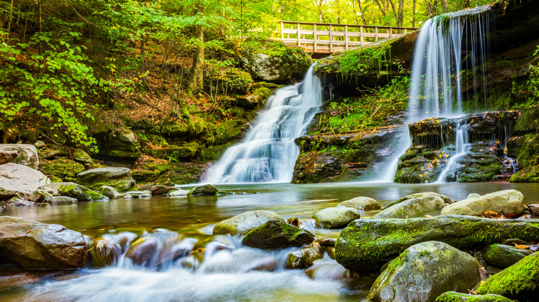
The Devil's Path in the Catskills is one of the most challenging hikes in the eastern United States. Known for its steep climbs, unstable footing, and rugged terrain, this trail is not for the faint of heart. The path spans about 24 miles and is often rated as the hardest hike in the Catskill Mountains, with a 9,000 foot gain in elevation end to end. Hikers face a relentless ascent and descent, including steep rock scrambles, narrow ledges, and sections where one wrong move could send you plummeting to the valley below. One of the toughest stretches is between Twin and Indian Head Mountains, where hikers must navigate rock scrambles with barely any foothold. If that wasn't enough, once hikers are near the summit, there is one more 10-foot steep cliff to overcome before completing the hike.
The trail's difficulty is compounded by unpredictable weather, especially in higher elevations, where storms can roll in without warning. During wet conditions, the rocks become slick and treacherous, making footing even more precarious. In the winter, snow and ice create additional hazards, turning parts of the trail into dangerous slides.
Adding to the challenge is the trail's remoteness. Injuries are not uncommon, with broken bones, and falls from ledges all reported as serious risks. Plus, there are few places for hikers to find shelter or assistance if something goes wrong.
The Huntington Ravine Trail boasts a killer combo of weather and terrain
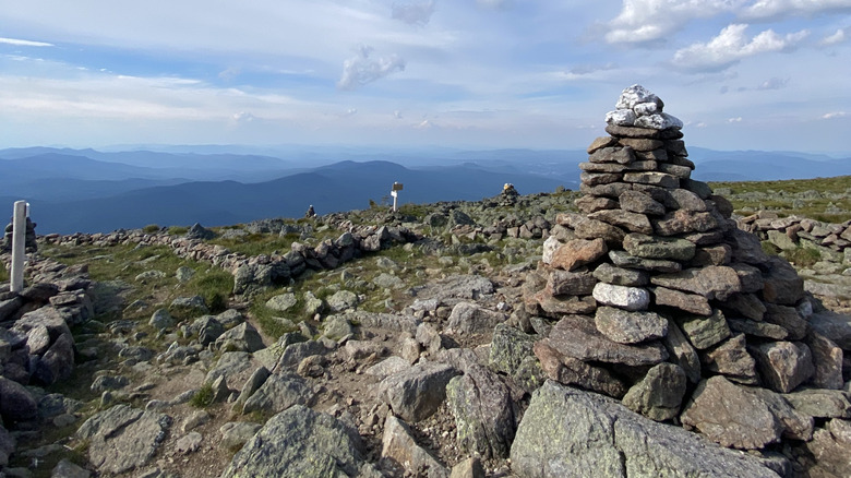
Mount Washington in New Hampshire is infamous for being an extremely challenging hike in New England, and for good reason. Mount Washington is notorious for having some of the worst weather in the world, with winds that can exceed 100 mph and temperatures that can drop below freezing even in the summer. Hikers can quickly go from sunny skies at the trailhead to blizzards, freezing rain, and thick fog at the summit. This drastic shift makes it hard to judge the weather along the trail, often causing folks to become over-ambitious — which is a massive hiking mistake one should avoid at all costs.
Of the trails to Mount Washington's summit, the Huntington Ravine Trail is considered one of the most dangerous. This trail is most often combined with the Tuckerman Ravine Trail, which is also a steep and challenging ascent before leading into the Huntington. The Huntington's rugged terrain features rocky scrambles, exposed ridgelines, and sections that require scrambling up near-vertical rock faces. Even in good conditions, the trail is demanding, but when a storm rolls in, it can turn deadly in a heartbeat. So much so, that even signage along the trail discourages hikers from embarking on it and officials caution from using the trail as a route of descent.
Due to its extremely difficult and dangerous weather conditions, even those with mountaineering experience are cautioned before embarking on this trail.
The Presidential Traverse is a real test of endurance
This strenuous 23-mile route traverses all of the major peaks in the Presidential Range, which includes the summit of 13 separate mountains. The length alone is enough to deter folks, but the total elevation gain is around 9,000 feet, adding to the difficulty. The trail requires long hours of hiking with steep ascents and descents, rocky terrain, and exposed ridgelines, making it a true test of endurance, stamina, and technical hiking ability. This is why this trail is considered to be one of the most challenging hikes along the northeastern United States.
One of the biggest dangers on the Presidential Traverse is the extreme weather conditions that can strike at any time. As we know, Mount Washington is infamous for unpredictable weather, but other mountains along the traverse, like Mount Jefferson, are also known for high winds which can make navigating their rocky slopes treacherous. Mount Adams, with its scree slopes, poses risks of unstable footing, and Mount Madison is known for its exposed ridgeline.
The sheer length of the hike also means that hikers need to pace themselves and plan for adequate hydration, food, and rest, as exhaustion can set in and be disastrous. Hikers who fail to properly manage supplies and energy also risk psychological and emotional challenges which can result in poor decision-making, disorientation, or miscalculations along their trek.
The Timberline Trail is not for the faint of heart
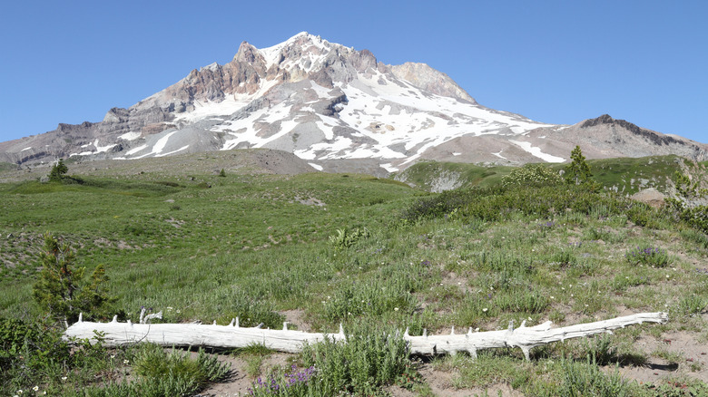
Circling the base of Mount Hood in Oregon, the Timberline Trail offers jaw-dropping views of glaciers, waterfalls, and alpine meadows. But make no mistake — this 40-mile loop is not a scenic stroll. It's a high-stakes test of endurance, navigation, and survival instincts. The ever-changing weather, river crossings, and unforgiving terrain combine to create one of the Pacific Northwest's most perilous hiking experiences.
The most infamous challenge on the Timberline Trail is crossing Eliot Creek, where a washed-out bridge leaves hikers to navigate the steep descent, cross the powerful stream, and scramble back up the opposite bank. While there is now an alternate route near Eliot Branch that avoids these depths, this alternate route is very long, making it unappealing to some hikers.
Finally, there's the sheer physical demand of the trail itself. It's not just the 40-mile distance — it's the 10,000 feet of total elevation change that grinds hikers down. Hikers must ascend and descend steep ridgelines, rocky switchbacks, and narrow paths — all while navigating high-altitude terrain that can cause rapid fatigue and exhaustion.
The Kalalau Trail's beauty is tempting, but treacherous
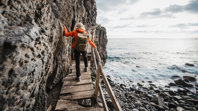
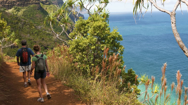
The Kalalau Trail on the Na Pali Coast of Kauai is as dangerous as it is beautiful. One of the most infamous hazards are the narrow, slippery cliffside paths. At certain points, hikers must navigate foot-wide ledges with sheer, 300-foot drop-offs into the rocky ocean below. Rain can turn the red dirt into slick, muddy slopes, making it easy to lose your footing. This combination of height, narrow paths, and slippery ground has led to numerous falls, some of them fatal. The Kalalau Trail's rugged, uneven terrain adds to the challenge. Hikers face jagged rocks, loose gravel and relentless uphill climbs that require strong endurance and balance. If something goes wrong, the remoteness of the trail means that rescue efforts can be delayed.
Another significant danger is the unpredictability of flash floods. The trail crosses multiple rivers and streams, including the notoriously hazardous Hanakapiai Stream. After heavy rain — which can happen suddenly on Kauai — these streams can swell into rushing currents, making crossings impassable. Hikers have been stranded for days or swept away trying to cross. The lack of reliable weather forecasts in this remote region makes it difficult to predict when conditions can turn deadly.
Despite these dangers, hikers continue to flock to the Kalalau Trail each year, drawn by the promise of stunning ocean views and waterfalls at the end. If you're planning to attempt this infamous trek, be prepared for the treacherous beauty of this deadly Hawaii trail.
The Buckskin Gulch is more than just a tight squeeze
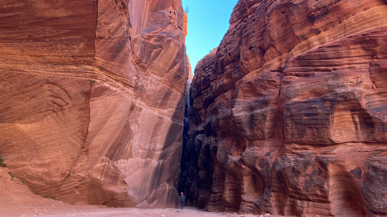
The Buckskin Gulch is one of the longest slot canyons in the world. Slot canyons are narrow, deep channels carved into rock, usually by water erosion over thousands of years. Unlike wide canyons, slot canyons have sheer, towering walls that close in tightly around you, sometimes narrowing to just a couple of feet across. Walking through one feels like threading a needle from the inside. It's stunning and mesmerizing to be surrounded by the smooth, swirling rock formations and shifting colors of light — but also claustrophobic — and when things go wrong, the canyon's design leaves little room for escape.
The most serious threat in the Buckskin Gulch is flash flooding. Rain doesn't have to fall directly overhead to cause a flash flood either; a storm miles away can send a sudden surge of water through the canyon, transforming it into a churning river. With walls reaching up to 500 feet high and no easy exits, hikers are essentially trapped. Many have been caught off guard, forced to scramble onto ledges or cling onto rocks. Not everyone makes it.
But floods aren't the only hazard. The canyon floor is a minefield of uneven rocks, sand, and debris from past floods, like tree limbs and jagged boulders. Poor lighting adds to the risk — sunlight barely reaches some stretches, leaving hikers in dim, shadowy conditions. And don't forget the wildlife. Rattlesnakes love the cool, dark crevices of slot canyons, and the Buckskin Gulch is no exception. One wrong step could result in a painful (and potentially life-threatening) encounter.
Angel's Landing: Where the final push could be fatal
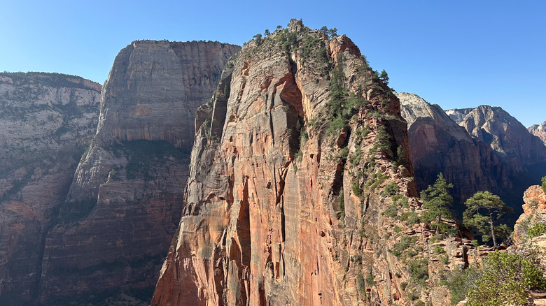
One of the most famous (and deadly) hikes in the U.S. is Angel's Landing in Zion National Park — 5.4 mile trek that promises glorious views for those who dare to face it. It's often described as a "high-risk, high-reward" hike, where every step matters.
The first part of the trail is relatively mild, winding through the canyon's valley and up switchbacks. The danger begins after you reach Scout Lookout—at which point a hiking permit is required to continue your ascent. From there, hikers must navigate the final half-mile to the summit, and this is where the hike earns its reputation. A narrow ridge with steep cliffs on either side leads to the summit, and hikers must hold onto chains bolted into the rock for support as they scramble up the rocky path. This final section has claimed multiple lives over the years, often due to falls caused by inexperience, poor judgement, or underestimating the physical demands of the trail. The high winds, especially near the peak, make balance tricky, and the narrow ledges with no guardrails can feel like a death-defying act. This stunning Utah hike is definitely not for the faint of heart. Even experienced hikers are advised to tackle this part of the trail with extreme caution.
The Crow Pass is a desolate, glacial path with real danger
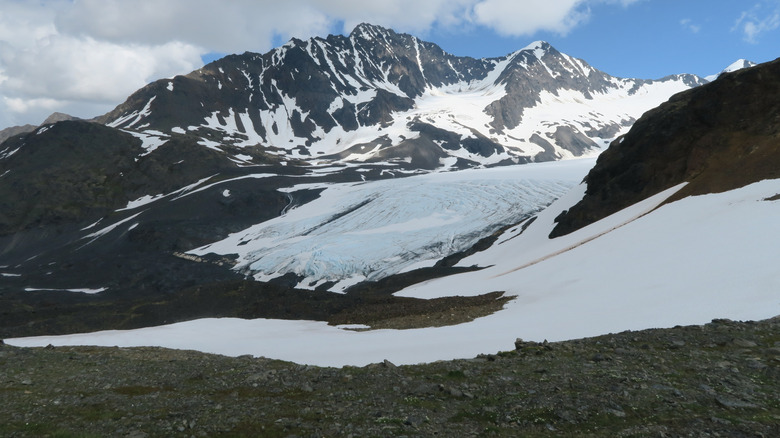
If you're looking for solitude on the trail, Crow Pass delivers — but not always in the comforting way you might hope. This 21-mile backcountry route in Alaska's Chugach Mountains is as remote as it is ruthless.
One of the most infamous dangers on the Crow Pass Trail is its river crossings. Glacier-fed streams surge with icy, fast-moving water. Crossing these waters requires precise timing, skill, and gear. In the spring and summer, snowmelt causes the river to swell, creating powerful torrents that can sweep unprepared hikers away. The fast-moving water combined with slippery rocks makes for a dangerous crossing, and hikers should approach with extreme caution.
Additionally, the weather in this region can change rapidly. Fog or sudden thunderstorms at higher altitudes can be especially harsh, and the rugged terrain can cause injuries if not navigated carefully. Avalanches are also a potential hazard, especially during the spring months when snow accumulations are higher. Since this hike is so far north, even in the summer, hikers are at risk of hypothermia. Wearing the proper winter gear, packing high-calorie snacks and warm supplies are essential for this hike.
Bright Angel Trail is a misleading path
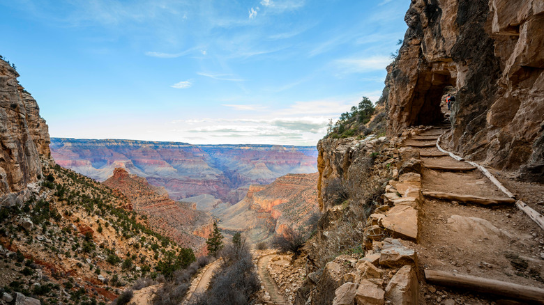
The name "Bright Angel Trail" may sound inviting, but don't let the name fool you. This popular route into the Grand Canyon is notorious for luring hikers into danger with its relatively easy descent — a gradual, well-maintained trail that makes the journey seem deceptively manageable. The real challenge begins on the way back up, where steep switchbacks, intense heat, and exhaustion combine to create a perfect storm for trouble.
The Grand Canyon's climate varies dramatically, with temperatures soaring well over 100°F in the summer months. The canyon acts like a giant oven, trapping heat and turning the hike into a brutal endurance test. Many hikers underestimate how much water they'll need or overestimate their physical capabilities, leading to dehydration, heat exhaustion, or worse. The National Park Service performs dozens of rescues on Bright Angel Trail every year, often for hikers who pushed themselves too hard without realizing the trail's punishing ascent takes twice the effort of going down. And these are just some of the reasons why Grand Canyon National Park is considered one of the deadliest in the United States.
Adding to the danger are sudden weather changes. During monsoon season, flash floods can wash through the canyon without warning, turning dry trails into rushing rivers. Even outside the wet season, the terrain is unforgiving — steep drop-offs line sections of the trail, and loose gravel underfoot makes it easy to slip. Despite the risks, Bright Angel Trail remains a bucket-list hike for many. If you attempt it, be prepared. Carry plenty of water, pace yourself, and remember that the views of the Colorado River at the bottom are only half the journey.
