This Underrated French Hike Is The Perfect Way To Take In The Local Culture

If you want to escape the Olympic-sized crowds (and prices) in Paris this summer, getting outside and heading to the Savoie department near the Swiss border is a great alternative. This beautiful region is home to Mont Blanc, the tallest mountain in the European Alps, and tons of other more approachable peaks. One mountain in particular, located near Chambery, France, provides unforgettable views and a classic regional charm. The area has a hike that will take you directly to Croix du Nivolet, a seven-story cross at the summit of the Dent du Nivolet. The massive cross looks fantastic against panoramic views of the distant Alps and nearby Lake Bourget.
You can reach this monument by foot from a nearby ski area known as La Feclaz or from one of several starting points in the valleys below the mountain, which we'll cover in detail. The walk to this cross takes you through magnificent French farmland, steep inclines in old-growth forests, and several kilometers of scenic ridgelines. It's well worth budgeting an entire day on this mountain to soak it all in. I was lucky enough to enjoy this hike with local guides who took me on the scenic route, stopping and grilling fresh sausage on the slopes of La Feclaz. You, too, can enjoy freshly toasted baguette on this mountaintop, and you don't even need to carry a grill up there to feast. So, follow along while we check out a great day outdoors Savoie-style.
What to pack for a hike in Savoie
In Spring, these mountains might have you alternating between slathering sunscreen and bundling up under your raincoat. Summer is more consistent, but you should still pack for all weather conditions before filling your bag with meats and cheeses. And if you're heading to the cross in winter, pack your cross-country skis. We split this packing list into two: with and without cookware. Before packing your charcoal, go to the Chambery tourist info center to confirm you're able to light fires and leave no trace. You can always pack a few dried sausages and cheese for a more leisurely mountaintop picnic or stop at the full-service restaurant halfway up (more on that later) for hot meals and hot chocolates.
For the hike, bring:
- Layers (at least one water/windproof jacket).
- Walking directions/GPS.
- Extra water bottles.
- Waterproof shoes.
- Sunscreen.
- Walking stick.
If you're going to grill, also bring:
- Cooking grid.
- Charcoal.
- Firestarters — check out these genius hacks for inspiration.
- Lighter.
- Pocket knife with a saw.
- Garbage bag.
Many regions in France have their own passionate take on sausage and dairy products. Since this hike sits squarely in the Savoie department, it's best when fueled by food with the Savoie flag. Look for the red and white local flag to mark products from this region in grocery stores, or better still, fuel your hike from local butcher shops and fromageries.
Where to start your hike
Chambery locals love being outside. They love it so much that they'll encourage you to take this trek no matter how much it's rained previously. They might even tell you to go if there's some rain in the forecast. They're probably right — the gigantic cross makes this trip worthwhile, even when it's wet. Luckily, there are several different starting points for this hike, so if the weather is particularly rough or you're just not feeling it, you can begin your day halfway to the cross and limit your exposure.
If the weather's nice and you feel frisky, follow Le Nivolet en boucle depuis Pragondran. We followed this loop from a parking lot in Pragondran and thoroughly enjoyed climbing through French farmland and switchback terrain to reach the top. The pathway is officially marked at 5.5 hours and 11 kilometers, but our Smartwatch data reported that it took us around 10 hours and 17 kilometers from car door to door. Finding a secluded area, gathering wood, and starting a fire in a wet bush are likely to blame for most of that additional time and distance.
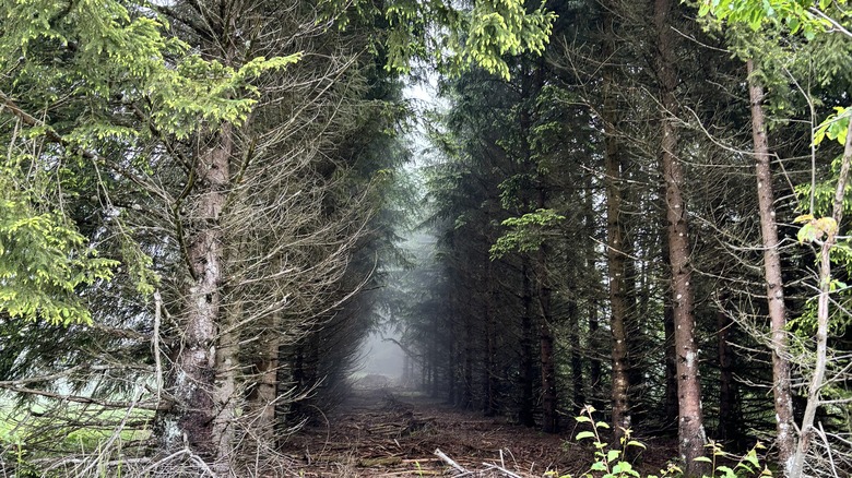
You can also start from the La Sire parking lot, which cuts the route in half to roughly 2.5 hours and 6 kilometers. This walk skips the foggy forests and cattle fields at lower elevations, as well as a significant chunk of the worst uphill sections, but don't worry; there's plenty of climbing from either starting point.
Stop at the Chalet Du Sire
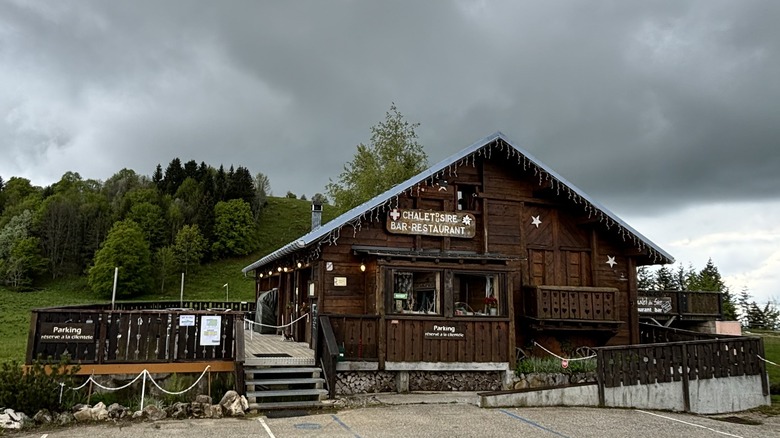
There are several routes to get to the cross. The best of them will take you right past Chalet Du Sire, a restaurant at the La Féclaz parking area. You can reach the chalet after passing through the most strenuous inclines of the hike, or you can reach it in a Renault Captur. Either way, you'll be greeted with coffee, croissants, and Savoie specialties.
Both routes I described in earlier pass right through the hefty bread and cheese raclettes served at this Chalet. If I hadn't been guided by a few folks who lived there, I would never have carried a grill up this mountain; I would have just eaten here. Even though I loved our sausage sandwiches, I'd be lying if I said I wasn't a bit jealous of the hot, melty cheeses served here. About 100 meters from the restaurant, you'll find the only bathroom and potable water on the entire hike, so fill your bellies and water bottles here.
The chalet also marks the split in the pathway. Depending on where you want to go next, you can either march up the ridge behind the Chalet to head directly towards the cross or meander up the ski runs across the street to grill on the mountaintop. There are countless pathways that all wind up at scenic spots for a picnic lunch. As long as you follow paths pointing upwards, you're headed in the right direction.
Getting to the top
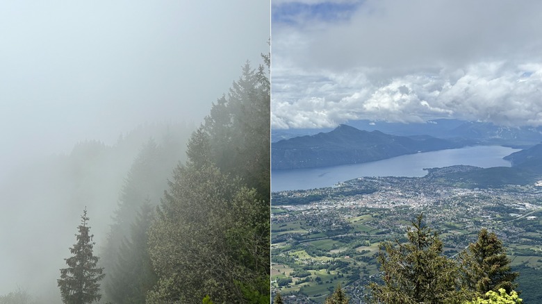
I can't tell you exactly where we stopped to grill — and it's not because I've sworn to secrecy. It's because I've got no clue. We went up a ski run shrouded in thick fog and came down a completely different path. Just keep going up until you can't anymore, and then settle down where there's a break in the trees. When you first arrive, you might see nothing but clouds, but the constantly changing weather means you're never more than a gust of wind away from glory. If you hang out long enough, the gray might give way to sunshine and a great view of Lake Bourget below.
As long as you have a chance for that view, you're ready to set up shop, so use our tips for the perfect campfire build and get a base layer going. It won't be easy, especially if it's been wet, but it'll make your lunch taste that much better. Once your charcoal has caught, that's the moment you've really reached the summit. Sit back and let someone else do the work if you can, or get to grilling. Finally, all that's left to do is eat, eat, and eat some more — maybe with a quick nap between courses.
P.S. – There are trash, glass, and recycling containers at the Chalet Du Sire. Use them.
Reaching the Croix du Nivolet
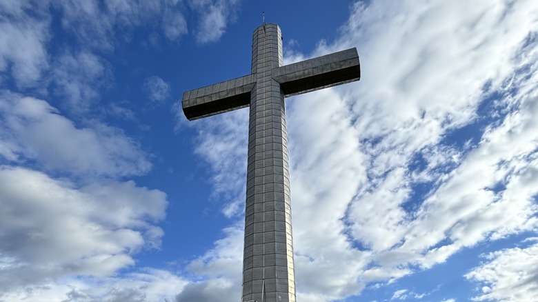
Everywhere you walk in Europe, history towers over you, which makes the sheer magnitude of Croix du Nivolet even more impressive. In a continent full of thousand-year-old houses, ancient churches, and medieval palaces, this 72-foot-high cross still stands out. With the fog blowing around, it feels like a lightning bolt might strike it any moment. We were half-expecting a booming voice to strike from the heavens, but the only booms we heard were the burps of our sausage-satisfied bellies.
Our group grilled on the ski mountain near the Chalet Du Sire and knocked out the final few kilometers of the ridgeline to the cross unencumbered by raw meat. Reaching this landmark means you're roughly 3/4 through your day. If you parked at the chalet, the Cross du Nivolet is the exact midpoint of your hike. If you're coming from Pragondan, the descent back to the car park begins cross-adjacent.
Take another look and soak it all in because the long and winding road to your car starts now. Budget plenty of time for the way down, especially if you catch it wet. We waded through the worst stretches of mud on the return portion of the hike. The long descent will give you a chance to get a rhythm going and slip into your own headspace for a while, satisfied, tired, and ready for a shower.